A weak clipper system could bring some light snow showers late Wednesday.
Winter has firmly returned to the Bluegrass, and it was noticeable again Tuesday across Central and Eastern Kentucky. Lingering clouds and flurries greeted early risers, with temperatures in the upper teens and low 20s. Wind chills dipped into the single digits for a time. Eventually, drier air moved in from the southwest, allowing some sunshine to break through, but it offered little help with warming. Afternoon highs struggled to reach the upper 20s in northern areas, with a few low 30s farther south.
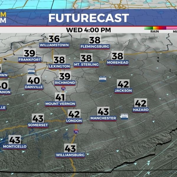
As the final day of 2025 arrives, a series of disturbances and clipper systems will move through the Great Lakes and Ohio Valley. These systems will keep clouds around and could produce a few snowflakes as people head out to ring in the new year. With a breezy west to southwest wind, afternoon highs should rebound into the upper 30s in most locations despite the cloud cover. It will still feel quite chilly, so those with New Year’s Eve plans should dress accordingly. A weak cold front moving in late Wednesday evening could spark a few light snow showers across the Bluegrass and areas to the east and north, possibly leaving a light coating on the ground into the early hours of 2026.
Thursday should bring a quiet start to the new year as the departing clipper carries any lingering snow showers away during the early morning hours. The first day of 2026 will feature another push of colder air behind the front. While noticeably colder, temperatures should only dip a few degrees, with highs reaching the mid-30s. Sunshine may be limited through the first few days of the new year as a wave of energy passes to the south late Friday. Forecast trends have shifted the moisture farther south, reducing the chance for chilly showers, but clouds are expected to linger. Highs should rebound into the low to mid-40s.
The first weekend of 2026 looks calm and dry overall. Saturday should bring a mix of clouds and sunshine, with afternoon highs easing back into the low 40s due to an easterly breeze tied to low pressure moving off to the southeast. Temperatures should rise slightly on Sunday, with the warming trend continuing into early next week. By Monday, highs may climb into the upper 40s, a few degrees above average for early January. A dry front may pass through Tuesday, bringing a few clouds and a modest cooldown, with highs returning to the low 40s.
36-Hour Forecast:
Tuesday Night: Scattered clouds with steady temperatures. Lows in the mid-20s. Wind southwest at 5 to 10 mph.
Wednesday: Mostly cloudy and breezy. Highs in the upper 30s to low 40s. Wind southwest at 10 to 15 mph.
Wednesday Night: A few snow showers and colder conditions. Lows in the upper 20s. Wind west at 5 to 10 mph.
This article has been carefully fact-checked by our editorial team to ensure accuracy and eliminate any misleading information. We are committed to maintaining the highest standards of integrity in our content.


Leave a Reply