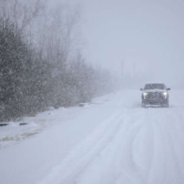
JACKSON, Ky. — The National Weather Service in Jackson has issued a Winter Weather Advisory for much of eastern and southeastern Kentucky through tonight and early Tuesday, as snow showers continue sweeping across the region.
The advisory includes Fleming, Rowan, Pulaski, Laurel, Harlan, Pike, and Bell counties, where snow accumulations are forecast to range from around 1 inch in valleys to up to 3 inches at higher elevations. Some mountain areas above 2,000 feet could see locally higher totals.
Forecasters caution that slippery roads and reduced visibility will make travel hazardous this evening and into Tuesday morning’s commute. The heaviest snow is expected to fall through late evening before gradually tapering off overnight.
While most of the snow will accumulate on grassy and elevated surfaces, untreated or shaded roads may quickly turn icy. Drivers are advised to slow down, use extra caution, and check goky.ky.gov or 511 for the latest road conditions before traveling.
Meteorologists also warn that temperatures near freezing overnight could lead to patchy black ice early Tuesday, especially across mountain counties near the Virginia border.
This article has been carefully fact-checked by our editorial team to ensure accuracy and eliminate any misleading information. We are committed to maintaining the highest standards of integrity in our content.


Leave a Reply