

A stretch of crisp, pleasant weather in the Northeast will give way to a more unsettled pattern later this week.
According to the National Weather Service, most of the region will remain dry on Wednesday, August 26, with temperatures around 80 degrees and light winds.
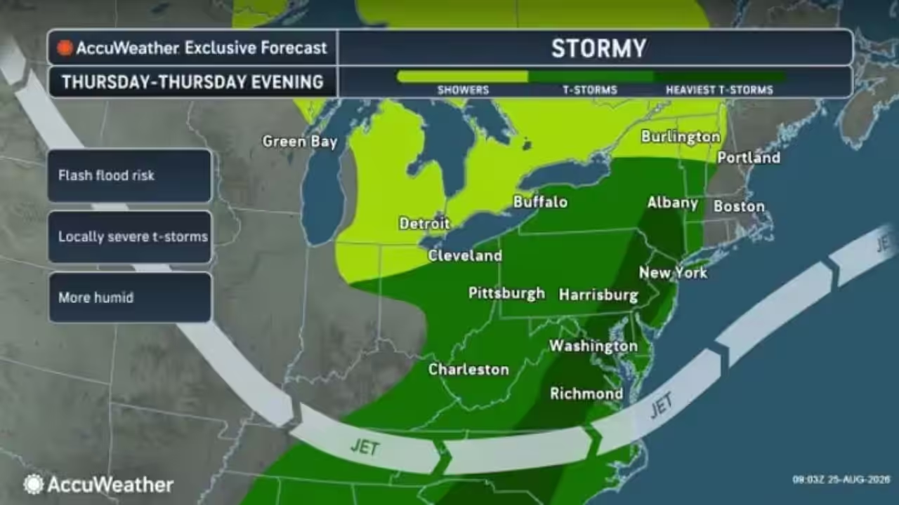
The change becomes more obvious on Thursday, August 27, when warmer, more humid air returns and a frontal boundary approaches.
The National Weather Service Storm Prediction Center predicts clouds and scattered showers in sections of the Northeast and Mid-Atlantic, but no widespread severe weather event is expected.
AccuWeather predicts a more active period Thursday afternoon and evening across sections of Pennsylvania and New York, as well as south into the Mid-Atlantic, with showers, thunderstorms, locally severe storms, and the possibility of flash flooding in certain locations.
Showers and thunderstorms are expected to develop across areas of the Northeast on Thursday, August 27, with locally severe storms likely.
The move comes after an exceptionally cold start to the week.
According to AccuWeather, Canadian air will maintain temperatures 5 to 10 degrees below historical averages in parts of the interior Northeast through Tuesday. The pattern begins to weaken on Wednesday, with warmer, more humid air spreading eastward on Thursday.
Cool, low-humidity conditions will dominate much of the Northeast on Tuesday, August 25, before temperatures begin to rise on Wednesday, August 26.
“Nighttime temperatures are expected to fall into the 50s and 60s,” AccuWeather Senior Meteorologist Brett Anderson stated. “Across the interior Northeast, especially from the Adirondacks south into northern Pennsylvania, lows will likely bottom out in the 40s during the period.”
Behind the front, conditions should cool and dry out on Friday, Aug. 28, with highs ranging from the mid-70s to low 80s.
Saturday, August 29, is forecast to be largely clear and pleasant over the Northeast and Mid-Atlantic.









Leave a Reply