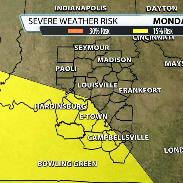
Thunderstorms have moved out, and Derby Week is quickly approaching. A shift in weather patterns could bring increased storm chances. Louisville is currently down 6.32 inches of rain since January 1, so rain is needed — but it may come with the risk of severe weather. As of now, Monday carries a 15% risk area just southwest of the city.
As of Tuesday evening, data shows winds reaching about 55 mph roughly one mile above the ground. This exceeds the 40 mph threshold typically used to signal the potential for organized severe storms. However, this outlook is still about six days away, and wind is only one factor in storm development.
In terms of storm fuel, if storms arrive later in the day, instability levels could reach around 1,000 units. Generally, CAPE values below 1000 J/kg indicate weak instability, 1000 to 2500 J/kg suggest moderate instability, 2500 to 4000 J/kg indicate strong instability, and values above 4000 J/kg are considered extreme.
At this stage, many variables remain uncertain, and conditions could change. Right now, damaging winds appear to be the main concern for Monday. There are no strong indications of a major severe weather outbreak in the area, but updates will continue as the forecast evolves.


Leave a Reply