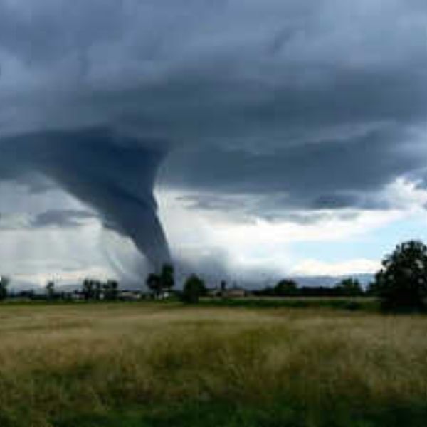
Severe weather, including the possibility of tornadoes, could impact the Louisville metro area late Saturday night into early Sunday morning, according to the National Weather Service office in Louisville, Kentucky.
Forecasters say a powerful cold front is expected to move through the region beginning around 10 p.m., bringing strong winds and a 5–9% chance of tornadoes within 25 miles of Louisville. Wind gusts could reach up to 75 mph, creating the potential for significant damage.
Temperatures are also expected to drop sharply overnight, falling from the 70s Saturday evening to the low 40s by 6 a.m. Sunday.
Areas Under Higher Risk
Jefferson County, Kentucky is under an enhanced risk for severe storms, the third-highest level on the five-tier scale used by the National Weather Service.
The enhanced risk area also includes:
-
Bullitt County, Kentucky
-
Oldham County, Kentucky
-
Clark County, Indiana
-
Floyd County, Indiana
Parts of Shelby County, Kentucky and Spencer County, Kentucky are also included in the elevated risk zone.
Western Kentucky Faces Highest Tornado Risk
The greatest tornado threat is forecast across the western half of Kentucky, particularly the Jackson Purchase region. Forecasters estimate a 10–14% tornado probability in that area, with storms possibly arriving around 9 p.m.
Damaging Winds a Major Concern
Strong winds are expected to be one of the primary hazards. Officials say areas as far east as Bowling Green, Kentucky have about a 45–59% chance of severe wind impacts. The Louisville, Kentucky area has a 30–44% chance of experiencing damaging winds.
A wind advisory remains in effect from 9 a.m. Saturday until 8 a.m. Sunday, with widespread gusts expected between 40 and 50 mph.
Possible Snow After Storms
After the storms pass, colder air moving into the region could cause rain showers to transition into snow early Sunday, possibly leaving a light dusting on some surfaces.
Safety Reminder
Because the strongest storms are expected to move through overnight, weather officials urge residents to prepare in advance. Recommended precautions include:
-
Enabling weather alerts on phones
-
Having multiple ways to receive warnings
-
Identifying a safe place to shelter if tornado warnings are issued
Officials say preparation is especially important since severe weather during nighttime hours can be harder to detect.


Leave a Reply