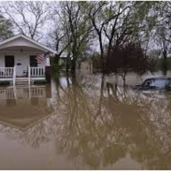
Louisville, Kentucky — Flooding along sections of the Ohio River and nearby waterways is expected to continue across the Ohio Valley as another round of rain moves through the region before a cold front ends the wet pattern.
According to the National Weather Service Ohio River Forecast Center, minor to moderate river flooding is ongoing across Indiana, southern Illinois, and northwest Ohio as runoff from recent rainfall keeps waterways elevated. River data released late Wednesday morning showed several gauges still reporting flood levels across tributaries feeding into the Ohio River.
Meteorologists say another 1 to 2 inches of rain could fall across the middle of the Ohio Valley through early Thursday, particularly in southern Indiana, western Kentucky, and parts of central Kentucky. The additional rainfall could slow the drop in river levels and extend flooding in low-lying communities.
The Ohio River flood crest is currently moving downstream and is expected to pass the confluence with the Wabash River later Wednesday. This could keep water levels elevated for communities downstream that depend on riverfront roads and levee systems.
Residents in flood-prone areas are encouraged to monitor river gauges and local emergency alerts. Officials advise avoiding flooded roadways and preparing for possible road closures near riverfront communities.
Conditions are expected to improve after the cold front moves through the region late Thursday, although river levels could take several more days to fully recede across the Ohio Valley.


Leave a Reply