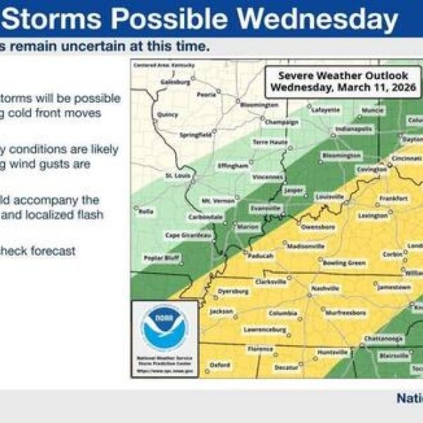
Virtually all of Kentucky is under a slight risk for severe weather on March 11, 2026, according to the National Weather Service.
Strong to severe thunderstorms are possible across Kentucky later this week as a cold front approaches, the National Weather Service said.
The severe weather threat is expected on Wednesday. Nearly the entire state is under a slight risk for severe weather that day, which is the second-lowest level on the NWS Storm Prediction Center’s five-level outlook scale.
A slight risk means severe thunderstorms with varying levels of intensity could develop. The NWS said it is still too early to determine the exact timing of the storms or the specific hazards that may occur.
Heavy rainfall could accompany the thunderstorms, potentially leading to flash flooding, according to the NWS.
Rain showers and thunderstorms are also possible Tuesday night, but forecasters say confidence that those storms will become severe remains low.
Temperatures are expected to fall after the storms move through with the arrival of the cold front. The NWS seven-day forecast for Lexington shows a high of 48 degrees on Thursday following three straight days of temperatures reaching the 70s.
Temperatures are expected to warm back into the low 60s on Friday and Saturday, according to the NWS.


Leave a Reply