ILLINOIS — A surge of arctic cold air is expected to sweep across central and eastern states on Thursday, raising the potential for isolated severe thunderstorms in parts of Illinois, Tennessee, Mississippi, and Alabama. Forecasters say the primary threat will be damaging wind gusts as moisture and storm energy move north ahead of the sharp cold front.
Cold front may trigger limited but strong storms
Meteorologists report that while overall moisture and instability will be limited, the dynamics of the system are strong enough to support a few isolated severe storms Thursday afternoon and evening.
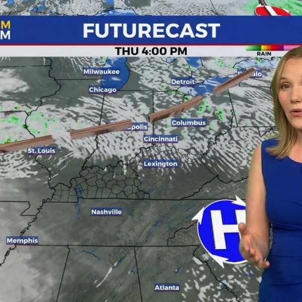
The risk zone stretches from eastern Illinois through Indiana, Kentucky, Tennessee, Mississippi, Alabama, and parts of the Southeast. Storms that do form may produce brief heavy rain, lightning, and wind gusts capable of causing localized damage.
Damaging winds are the main concern
Analysis indicates that strong straight-line winds pose the biggest hazard, potentially affecting travel and outdoor structures. Forecasters noted that while a widespread severe outbreak is unlikely, even isolated storms can generate hazardous wind bursts.
Cities within the yellow-highlighted zone — including Nashville, Memphis, Birmingham, Jackson, and parts of southern Illinois — should monitor conditions closely.
Temperature swings expected after the front
After the storms pass, the arctic air mass will bring sharp temperature drops, ending the recent unseasonable warmth. Many areas in the Midwest and South could see swings of 20–30 degrees within 24 hours.
Residents are advised to prepare for rapidly changing conditions, especially if traveling Thursday afternoon or evening. For ongoing severe weather updates, stay connected with NapervilleLocal.com.
This article has been carefully fact-checked by our editorial team to ensure accuracy and eliminate any misleading information. We are committed to maintaining the highest standards of integrity in our content.





Leave a Reply